Discover
Custom Drone Solutions
Our standard services cover most survey, mapping, and inspection work, but not every project fits a standard workflow. If you have a sensor you want flown, a site that needs a different approach, or an idea for a measurement that isn’t on our services list, we’ll look at it.
What We Can Work With
Your sensor or instrument
If you have equipment you’d like flown, we’ll assess whether it can be mounted and operated safely, and what it would take.
A different way of flying
Some sites don’t suit automated grid flights. Confined spaces, low-altitude work, and near-surface flying all call for a different method.
Your data requirements
If your team needs outputs in a particular format or structure, tell us up front and we’ll plan around it.
How It Works
- Tell us the goalYou describe what you’re trying to measure or capture.
- FeasibilityWe assess the equipment, the site, and the regulatory requirements for the setup, such as whether a Special Flight Operations Certificate (SFOC) or other approvals are needed.
- TestingWhere a configuration is new, we test it before field work.
- Fly and deliverWe fly the job and deliver the data.
All flights are flown by Transport Canada–certified pilots. For more on how federal, provincial, and municipal rules can apply to a site, see our post on drone regulations in Ontario.
We’ve Done This Before
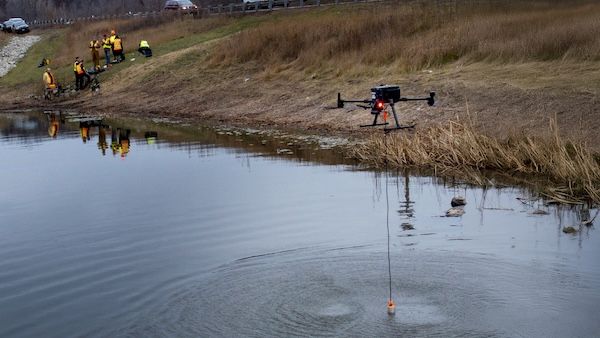
When we added bathymetric surveying, we took on a new type of sensor, taught ourselves tethered, near-surface flying, and redesigned our sonar mount after a clamp failed during training (full story here). On our Pioneer Memorial Tower 3D model, we switched to manual flying where automated flight paths left gaps.
An Honest Assessment Up Front
Not every idea works from a drone. Payload weight, flight time, sensor stability, and regulations all limit what’s practical. If a drone isn’t the right tool for what you need, we’ll tell you early.
Have a Sensor or Idea in Mind?
Tell us what you’re trying to measure and where.
Start the conversation