
Discover
Volumetric Analysis in Southern Ontario

Volumetric Analysis in Southern Ontario
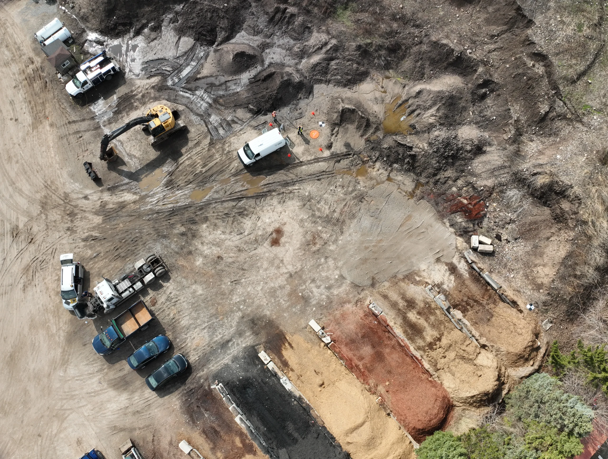
At Trillium Imaging Services, we deliver precise drone-based volumetric analysis using LiDAR and photogrammetry, giving construction managers, aggregate operators, and site engineers the accurate material measurements they need — quickly, safely, and without interrupting operations. Whether you’re tracking earthwork progress, quantifying stockpile inventory, or calculating cut-and-fill for an active construction site, our drone surveys provide the reliable volumetric data required for informed decision-making.
What We Offer
Stockpile Measurement & Inventory
Accurate volume calculations for aggregate, soil, and material stockpiles — captured from the air without manual measurement or site disruption.
Cut & Fill Analysis
Precise earthwork calculations comparing design grades to existing terrain, supporting construction progress tracking and contract verification
LiDAR & Photogrammetry Data Capture
We select the right method for each project — LiDAR for complex surfaces and low-light conditions, photogrammetry for high-resolution visual documentation alongside volume data.
3D Surface Models & Comparison Reports
Detailed before-and-after surface models that clearly communicate earthwork changes, material movement, and site progress over time.

Who Uses Our Volumetric Analysis Services?
Construction Managers & General Contractors
For tracking earthwork progress, verifying contractor quantities, and maintaining accurate records throughout the construction lifecycle.
Aggregate & Mining Operations
For regular stockpile inventory counts, material management, and compliance reporting without halting site operations.
Civil Engineers & Design Firms
For validating cut-and-fill calculations against design intent and identifying discrepancies early in the construction process.
Land Developers For monitoring grading operations, managing material costs, and documenting site conditions at key project milestones.
Municipal & Public Works Departments
For tracking material quantities on road construction, landfill management, and large-scale infrastructure projects.
Equipment & Capabilities
Industry-Leading Drone Platforms
Professional-grade drone platforms with high payload capacity and precision flight control, supporting both LiDAR and photogrammetry sensor packages for consistent, repeatable data capture.
LiDAR & Photogrammetry Sensors
We select the optimal data capture method based on site conditions — LiDAR excels on irregular surfaces and through dust or low light, while photogrammetry provides high-resolution visual context alongside volume data.
RTK GPS & Ground Control Points
RTK positioning systems combined with precisely surveyed ground control points (GCPs) deliver centimeter-level accuracy on every volumetric calculation.
GIS-Compatible Data Outputs
Receive data in your preferred format — LAS, DXF, GeoTIFF, or PDF reports — ready for immediate use in your project workflow.
Certified Advanced Drone Pilots
All flights are conducted by Transport Canada certified professionals in full compliance with Canadian aviation regulations.


Sample Use Cases
Regular stockpile inventory surveys for aggregate and quarry operations.
Cut-and-fill progress tracking on active subdivision and road construction sites.
Pre- and post-grading surface comparisons for earthwork contract verification.
Material volume documentation for landfill and waste management facilities.
Rapid site assessments for construction claims and dispute resolution.
Why Choose Trillium?
Fast turnaround times
Detailed, engineer-ready reports
Fully insured and Transport Canada compliant
Experienced team with proven results across Ontario


Serving Southern Ontario
We proudly provide bathymetric measurement services across:
Cambridge, Kitchener, Waterloo, Hamilton, Brantford, Guelph, and surrounding areas.
Ready to Get Started?
Trillium Imaging supports engineering firms, environmental consultants, and construction managers with drone-based surveys, bathymetric mapping, thermal inspections, and volumetric analysis across Southern Ontario. Contact us to discuss how our geospatial services can support your project goals.
Partners, Training & Regulatory Authorities
Industry & Regulatory
Training & Certification