
Discover
Infrastructure Inspections in Southern Ontario

Infrastructure Inspections in Southern Ontario
At Trillium Imaging Services, we deliver high-resolution visual and thermal drone inspections giving asset owners, facility managers, and engineering firms the detailed condition data they need — safely, efficiently, and without costly shutdowns or scaffolding. Whether you’re assessing a rooftop for moisture intrusion, inspecting a telecom tower for structural wear, or identifying underperforming solar panels, our drone inspections provide the reliable documentation required for informed maintenance and capital planning decisions.
What We Offer
High-Resolution Visual Inspections
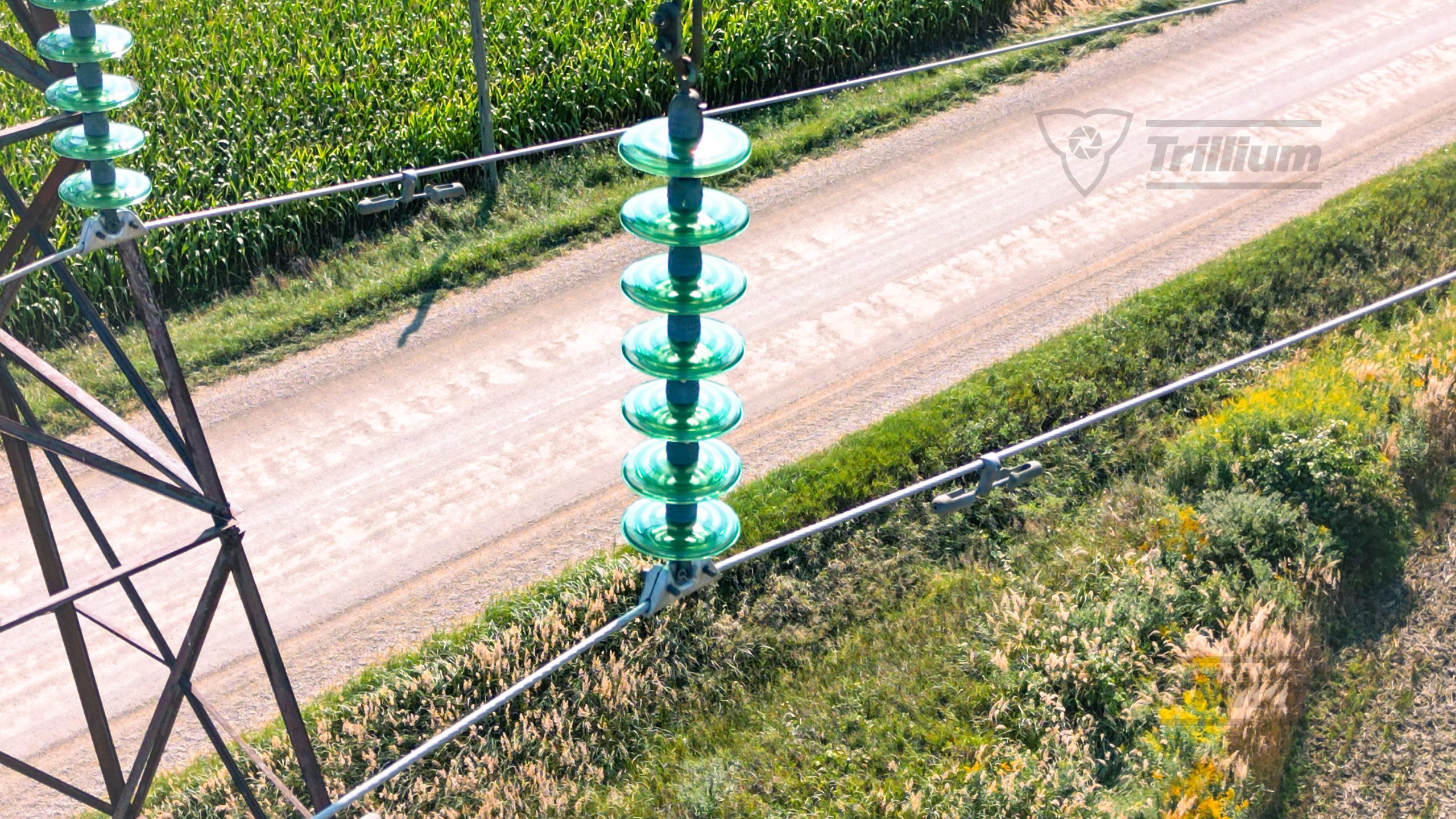
Detailed RGB aerial imagery capturing surface conditions, structural defects, and physical deterioration across all asset types — including transmission lines, pipelines, and corridor infrastructure — documented with precision from angles inaccessible to ground crews.
Thermal Imaging Inspections
Drone-mounted thermal cameras capture radiometric thermal data across your asset, producing imagery that displays temperature gradients across all surfaces — ideal for detecting heat anomalies along hydro lines, electrical components, and pipeline infrastructure for review by your inspection or maintenance team.
Combined Visual & Thermal Surveys
For the most complete picture, we capture both RGB and thermal data in a single flight — delivering side-by-side visual and thermal documentation of your entire asset, whether it’s a rooftop, a transmission corridor, or a pipeline right-of-way.
Photo Reports
Professionally compiled inspection reports with annotated high-resolution images, ready to share with your engineers, inspectors, or maintenance teams.
Thermal Imagery with Temperature Gradients
Calibrated radiometric thermal images displaying surface temperature gradients across your asset — giving your qualified inspectors the data they need to make informed maintenance decisions.
Raw Image & Data Files
All raw photo and thermal files delivered alongside reports for your own records or further analysis by your team.

Who Uses Our Inspection Services?
Facility & Property Managers For routine rooftop condition assessments, moisture detection, and building envelope inspections without disrupting occupants or operations.
Telecom & Tower Owners For safe, efficient structural inspections of towers, antennas, and support infrastructure — eliminating the need for climbers on routine surveys.
Solar Farm Operators & Developers For thermal panel-by-panel inspections identifying hotspots, delamination, and underperforming cells across large arrays quickly and accurately.
Bridge & Infrastructure Owners For detailed visual condition assessments of bridge decks, soffits, piers, and abutments — safely capturing data in areas difficult or dangerous to access on foot.
Hydro & Electrical Utilities For visual and thermal inspections of transmission lines, distribution corridors, towers, and electrical components — covering large stretches of infrastructure efficiently without the need for ground crews or helicopter deployments.
Oil & Gas Pipeline Operators For aerial visual and thermal surveys of pipeline rights-of-way, detecting ground movement, vegetation encroachment, surface anomalies, and thermal irregularities along pipeline corridors.
Industrial & Manufacturing Facilities For inspections of rooftops, stacks, storage tanks, and large structures where traditional access methods are costly, slow, or hazardous.
Insurance & Engineering Firms For objective, documented condition evidence supporting claims assessment, due diligence, and asset valuation reports.
Equipment & Capabilities
Industry-Leading Drone Platforms Professional-grade drone platforms with precision flight control and high payload capacity, capable of carrying both visual and thermal sensor packages on a single flight.
Multi-Sensor Payload Systems Our inspection payloads combine visual and radiometric thermal cameras in a single unit — allowing us to capture detailed visual and thermal data together in one efficient flight.
Thermal Imaging Calibrated thermal cameras capture Thermal data displaying temperature gradients across asset surfaces, providing your qualified inspectors and maintenance engineers with the imagery they need to make informed decisions.
High-Resolution RGB Cameras Survey-grade visual cameras capturing sharp, detailed imagery of surface conditions, structural features, and physical defects at close range.
GIS-Compatible Data Outputs Receive annotated reports and raw files in your preferred format, ready for integration into your asset management system.
Certified Advanced Drone Pilots All flights are conducted by Transport Canada certified professionals in full compliance with Canadian aviation regulations.


Sample Use Cases
Rooftop thermal inspections for moisture and heat loss detection on commercial and industrial buildings
Tower and telecom structure visual assessments eliminating the need for climbers
Solar panel thermal surveys identifying hotspots and underperforming cells across large arrays
Bridge soffit and pier inspections documenting structural conditions safely and efficiently
Transmission line and hydro corridor inspections covering large distances quickly with combined visual and thermal data
Pipeline right-of-way surveys detecting surface anomalies, ground disturbance, and thermal irregularities along oil and gas corridors
Industrial facility inspections capturing hard-to-reach asset conditions without scaffolding or shutdown
Why Choose Trillium?
Fast turnaround times
Detailed, engineer-ready reports
Fully insured and Transport Canada compliant
Experienced team with proven results across Ontario


Serving Southern Ontario
We proudly provide bathymetric measurement services across:
Cambridge, Kitchener, Waterloo, Hamilton, Brantford, Guelph, and surrounding areas.
Ready to Get Started?
Trillium Imaging supports engineering firms, environmental consultants, and construction managers with drone-based surveys, bathymetric mapping, thermal inspections, and volumetric analysis across Southern Ontario. Contact us to discuss how our geospatial services can support your project goals.
Partners, Training & Regulatory Authorities
Industry & Regulatory
Training & Certification