

At Trillium Imaging, aerial mapping, drone inspections, and volumetric analysis have been part of our core service lineup for a while. Bathymetric surveying is our newer addition — and it came out of a specific project we read about.
A few years ago, Mohawk College’s applied research team partnered with the City of Hamilton to test drone-based echo sounder surveying as a way to more accurately and efficiently monitor the city’s stormwater ponds. The project was later shortlisted for a national Water Canada award. That was enough to get us looking seriously at the technology ourselves — and we’ve since built it into a full service offering.
So what exactly is a bathymetric survey, and how does the drone-based approach stack up against the traditional ways of doing it?
What a Bathymetric Survey Measures
A bathymetric survey maps the depth and shape of a water body’s bottom — essentially underwater topography. Municipalities use this data to plan stormwater pond maintenance and dredging schedules. Engineering firms use it for design work on retention facilities. Mining operations use it to track sediment accumulation in tailings ponds. In every case, the survey is only as useful as the data is accurate.
Traditional Methods, Briefly
Two methods have historically dominated this work:
Lead-line / manual sounding — a crew member takes individual depth readings by lowering a weighted line at set points, usually from a small boat or by wading. It’s simple and requires minimal equipment, but it’s slow, physically demanding, and only produces as many data points as someone can manually collect. Irregular pond bottoms are easy to miss between readings.
Boat-mounted single-beam or multibeam sonar — a step up in efficiency, using one or more sonar transducers mounted to a boat to log depth continuously along travel paths. Multibeam systems in particular produce dense, high-resolution data — but they’re typically mounted on larger boats, which simply can’t get into a stormwater pond or a narrow stretch of river. That limits this option to bigger, more open water bodies.
All of these methods also require personnel to be on or in the water, which introduces its own access and safety considerations.
What It Takes to Do This With a Drone
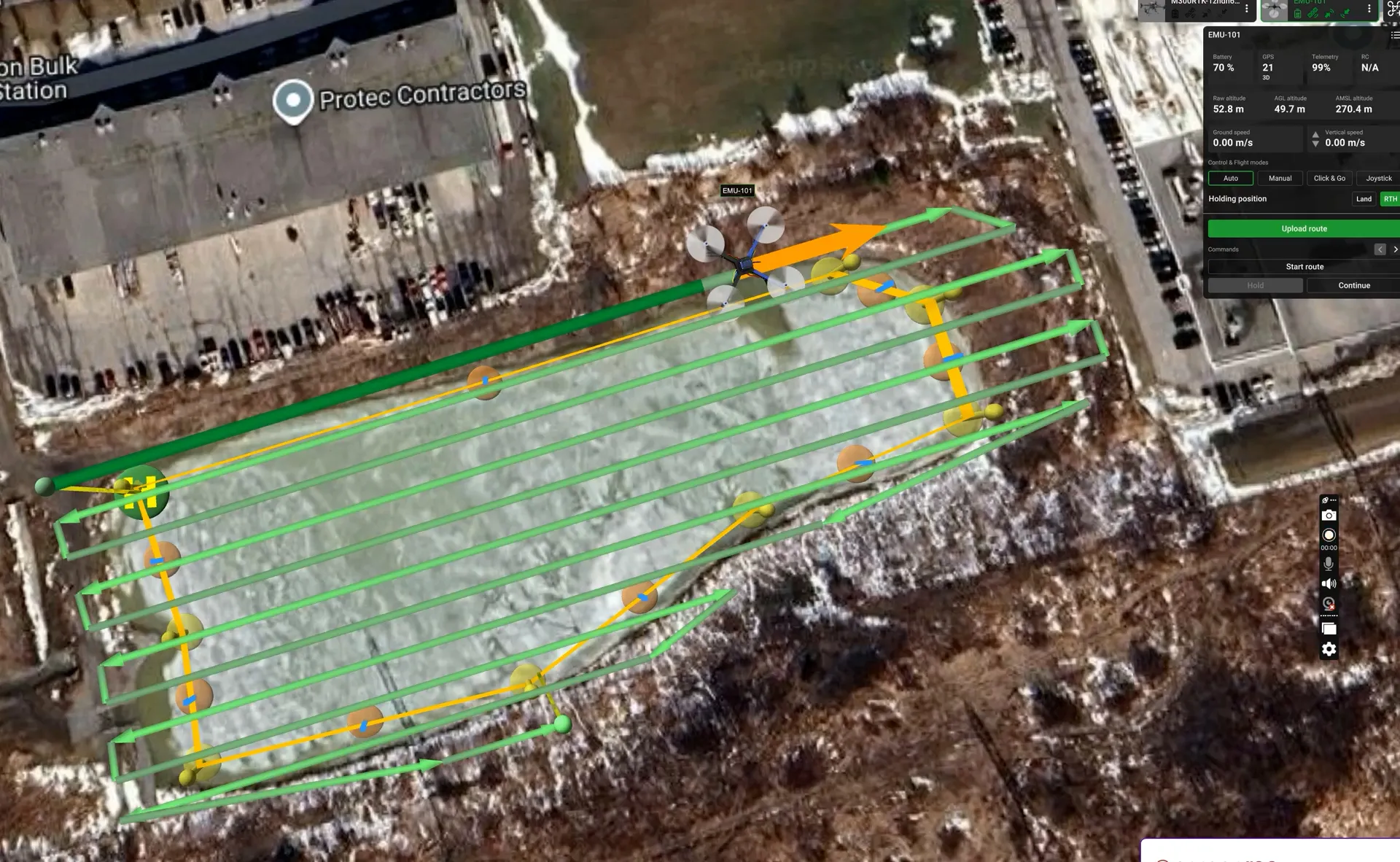
A drone-based bathymetric survey generally needs four things working together: a drone platform capable of carrying the payload, an echo sounder (sonar) to take the depth readings, a positioning system accurate enough to tie each reading to a precise location, and flight planning software to fly consistent survey lines over the water.
For the sonar itself, there’s a choice to make between single-frequency and dual-frequency systems. A single-frequency sonar gives you one depth reading — typically to the top of whatever it hits first, which in a pond with soft sediment might just be the sediment surface, not the actual hard bottom underneath. A dual-frequency sonar sends two frequencies at once, which lets it distinguish between the top of the sediment layer and the top of the underlying hard bottom (rock or consolidated material) in the same pass. That distinction matters if you’re trying to understand not just current water depth, but how much sediment has accumulated over time.
We landed on the EchoLogger ECT-D052S, paired with a DJI M300, mainly for that dual-frequency capability. For positioning, an Emlid RTK system with an NTRIP correction subscription ties each sonar reading to survey-grade GPS accuracy in real time, and flight paths are planned in UgCS so survey lines can be flown consistently and repeated later if needed.
Sensor Range and the Dead Zone
Every echo sounder has a working range, and this one is roughly 0.5 to 200 metres. The lower end of that range matters more than people expect: water shallower than about 0.5 metres sits in what’s called the sonar’s dead zone, where the signal is too close to the transducer to return a reliable reading. In practice, that means the very shallow edges of a pond or the margins of a stream may not be measurable by sonar at all, and need to be accounted for separately when planning a survey.
Benefits of Drone-Based Bathymetric Surveying
Data density and coverage. Continuous, GPS-guided sonar logging produces a far denser point cloud than manual spot-checks, capturing irregularities in the pond bottom that widely spaced lead-line readings would miss entirely.
Access and safety. Many stormwater ponds and small waterways have soft banks, deep silt, dense vegetation, or unstable slopes. Flying a drone over the water removes the need for a crew to wade in or launch a boat into terrain that isn’t built for it.
Hazardous liquid handling. Some sites — acidic containment ponds, contaminated water, or tailings ponds with elevated radioactivity — aren’t safe for a crew to enter under any circumstances. A drone-based system means no one needs direct contact with the water. In a worst-case scenario, the outcome is a damaged sonar unit that needs replacing, not a health and safety incident.
Speed of fieldwork. According to SPH Engineering, drone-based echo sounder systems can reduce survey time by roughly 75% compared to traditional methods, since the drone can fly a continuous grid pattern rather than a crew repositioning manually for each reading.
Positional accuracy. RTK-corrected GPS via NTRIP ties every single sonar reading to survey-grade positioning — SPH Engineering reports data from these systems showing 87% correlation with LiDAR validation in testing.
Repeatability. Because flight paths are programmed rather than flown by eye, follow-up surveys — say, tracking sediment accumulation in the same pond a year later — can repeat the exact same lines for a clean before-and-after comparison.
Where This Method Fits Best
Drone-based bathymetric surveying is well suited to stormwater management ponds, rivers and streams, and industrial or mining containment ponds — water bodies where access is limited, precision matters, and safety around the water itself is a real consideration.
It’s less suited to very large water bodies. For lake-scale work — the Great Lakes, for example — a boat-mounted multibeam sonar system is generally the better tool, since it can cover far greater areas per pass than a drone-based single or dual-beam system.
Planning a Bathymetric Survey in Ontario
If you’re managing stormwater infrastructure, planning dredging work, or need to understand sediment conditions in a pond or waterway, a drone-based bathymetric survey can get you accurate, GPS-tied data without putting a crew in the water. Get in touch to talk through whether it’s the right fit for your site.